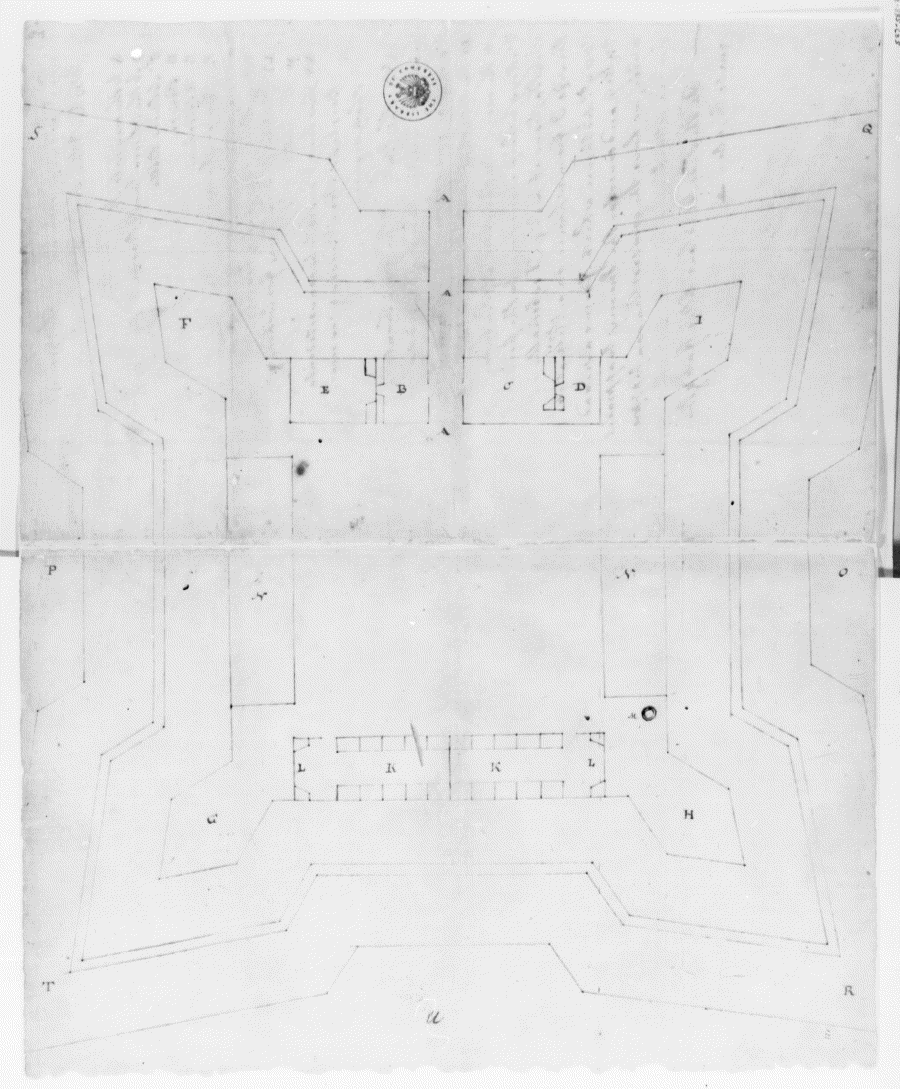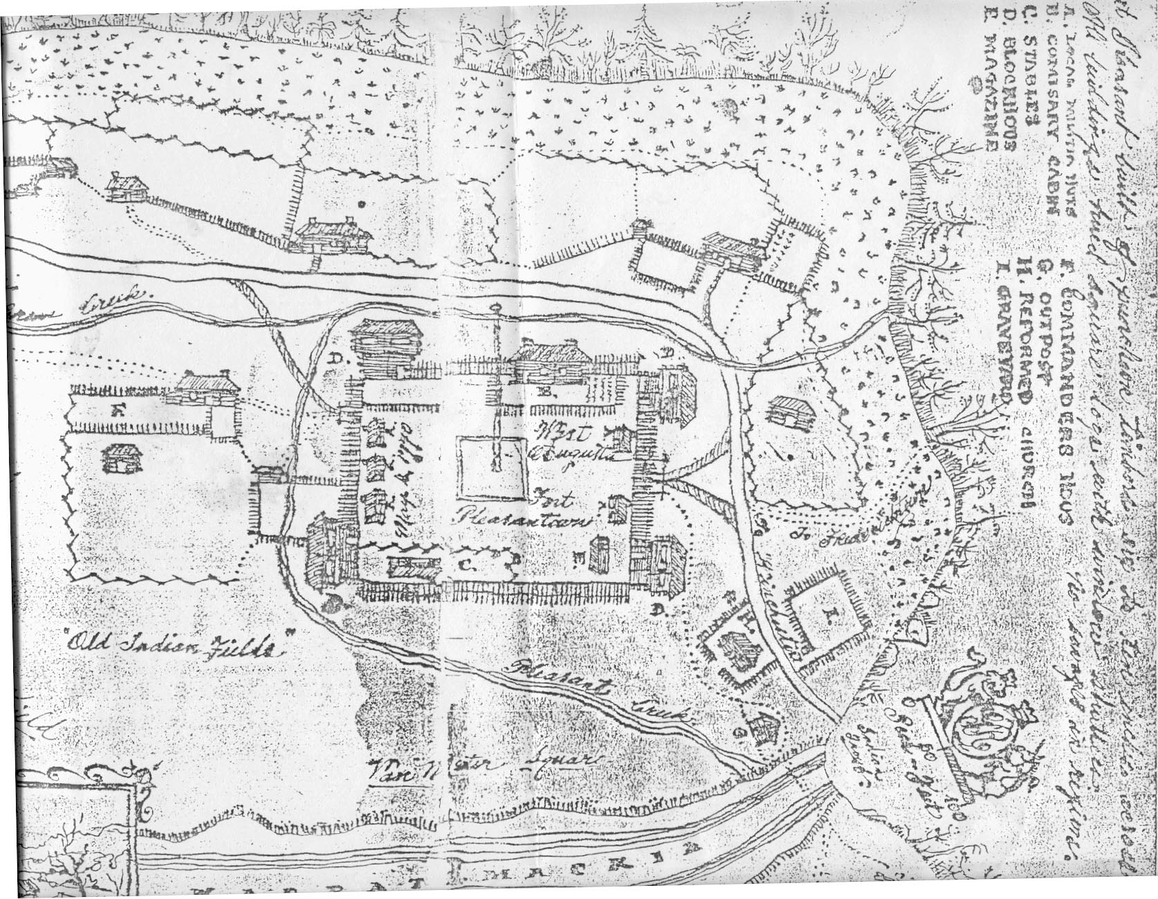
The above map/drawing is copied from a photocopy obtained by the author. The configuration and dimensions are very different from the plans drawn by Washington below. The above drawing may be a contemporary drawing of a later Fort Pleasant that served as the headquarters for the county militia. There is evidence that a Fort Pleasant existed during the Revolutionary War due to pension records indicating some members of the Hampshire County militia claiming to be stationed at Fort Pleasant and several letters written to then Governor Thomas Jefferson by the county lieutenant, Garrett Van Meter, stating the place of origin as Fort Pleasant. It is very unlikely that Washington's fort would still be standing by the date on the map of 1770. This fort would conform more to frontier fort construction of the Revolutionary and post-Revolutionary periods. It is not known where the original drawing is nor where the original was obtained.